
Heartlands Business Park
Introduction
The photograph on this page of Heartlands Business Park by Andrew MacKinnon as part of the Geograph project.
The Geograph project started in 2005 with the aim of publishing, organising and preserving representative images for every square kilometre of Great Britain, Ireland and the Isle of Man.

There are currently over 7.5m images from over 14,400 individuals and you can help contribute to the project by visiting https://www.geograph.org.uk
Heartlands Business Park
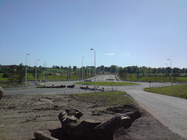
Image: © Andrew MacKinnon Taken: 29 May 2009
Looking over the Heartlands Business Park from the former Cowhill Farm. This picture shows the initial roads layout through the Business Park from the yet to be constructed Motorway junction. The main link through the business park in the centre of the picture, is of D2UAP or Dual 2 Lane Urban All Purpose, standard. Left centre of the picture is the D2UAP link which will be continued to the Motorway junction when constructed. The road at right bottom of picture is the temporary link to Balgornie Farm, which will be discontinued when a new link will be made from the new Motorway junction flyover.
Images are licensed for reuse under creativecommons.org/licenses/by-sa/2.0
Image Location

Latitude
55.863396
Longitude
-3.71026