The leaning Albert Clock, Belfast
Introduction
The photograph on this page of The leaning Albert Clock, Belfast by Albert Bridge as part of the Geograph project.
The Geograph project started in 2005 with the aim of publishing, organising and preserving representative images for every square kilometre of Great Britain, Ireland and the Isle of Man.

There are currently over 7.5m images from over 14,400 individuals and you can help contribute to the project by visiting https://www.geograph.org.uk
The leaning Albert Clock, Belfast
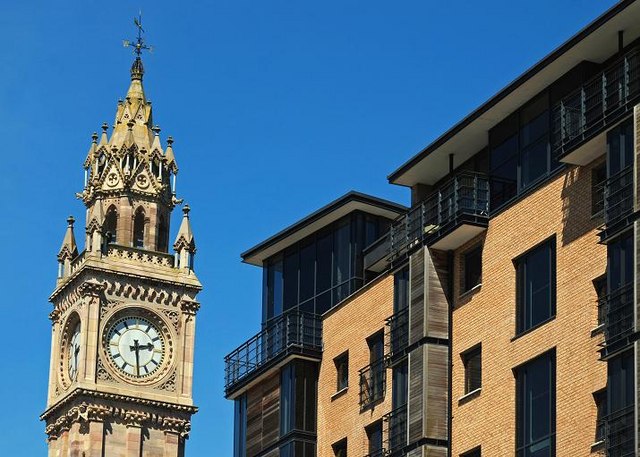
Image: © Albert Bridge Taken: 31 May 2009
To understand the reason for the clock’s lean you have to remember that it is built on reclaimed land and that ships once berthed at the bottom of Waring Street Image and High Street Image - Skipper Street Image also refers to this. Much of central Belfast is underlain by a deposit of soft mud and silt - "sleech". Inst Image and the Custom House Image are two buildings which are now lower than when built as a result of sinking into the sleech. The cross-harbour road and railway Image Image Image required foundations up to 60 metres deep before reaching firm ground. The clock is said to be 113 ft tall and to be 14ft off vertical (it was built to imperial measurements). The degree of lean can be appreciated in this comparison with the Custom House Square apartments Image completed this year. Image shows, for comparison, the view from the east.
Images are licensed for reuse under creativecommons.org/licenses/by-sa/2.0
Image Location
Latitude
54.600965
Longitude
-5.92246