Central Methodist Church, Bude
Introduction
The photograph on this page of Central Methodist Church, Bude by Humphrey Bolton as part of the Geograph project.
The Geograph project started in 2005 with the aim of publishing, organising and preserving representative images for every square kilometre of Great Britain, Ireland and the Isle of Man.

There are currently over 7.5m images from over 14,400 individuals and you can help contribute to the project by visiting https://www.geograph.org.uk
Central Methodist Church, Bude
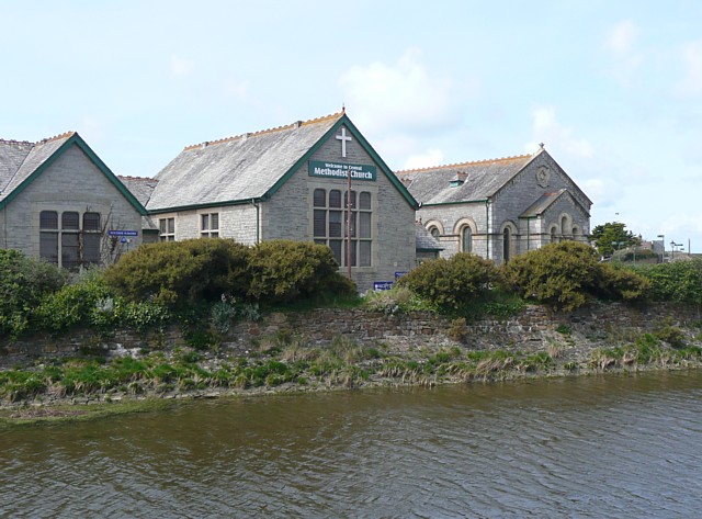
Image: © Humphrey Bolton Taken: 3 May 2009
The building with the cross and sign looks to have originally been a Sunday School, and it is the building on the right that looks like a chapel (originally Wesleyan).
Images are licensed for reuse under creativecommons.org/licenses/by-sa/2.0
Image Location
Latitude
50.828429
Longitude
-4.545903