St Albans: Griffiths Way gasometers
Introduction
The photograph on this page of St Albans: Griffiths Way gasometers by Nigel Cox as part of the Geograph project.
The Geograph project started in 2005 with the aim of publishing, organising and preserving representative images for every square kilometre of Great Britain, Ireland and the Isle of Man.

There are currently over 7.5m images from over 14,400 individuals and you can help contribute to the project by visiting https://www.geograph.org.uk
St Albans: Griffiths Way gasometers
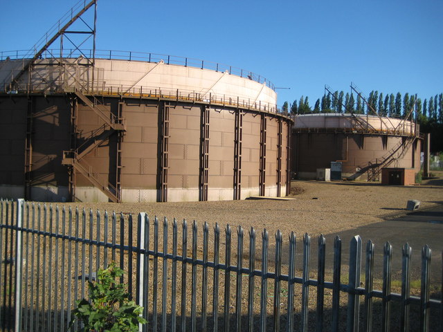
Image: © Nigel Cox Taken: 29 May 2009
From old Ordnance Survey maps it is evident that the site of the St Albans gas works was once much larger, stretching down to Stephen's Hill, and having its own dedicated railway siding, more or less on the site where Sainsbury's is now. These two holders are all that remains but they are large enough to warrant being individually represented on the current Ordnance Survey 1:50,000 scale mapping.
Images are licensed for reuse under creativecommons.org/licenses/by-sa/2.0
Image Location
Latitude
51.741253
Longitude
-0.340755