St Albans: Cottonmill Lane railway bridge
Introduction
The photograph on this page of St Albans: Cottonmill Lane railway bridge by Nigel Cox as part of the Geograph project.
The Geograph project started in 2005 with the aim of publishing, organising and preserving representative images for every square kilometre of Great Britain, Ireland and the Isle of Man.

There are currently over 7.5m images from over 14,400 individuals and you can help contribute to the project by visiting https://www.geograph.org.uk
St Albans: Cottonmill Lane railway bridge
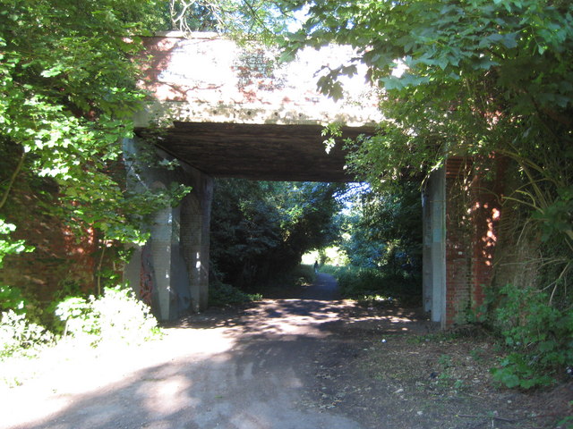
Image: © Nigel Cox Taken: 29 May 2009
Leaving St Albans Abbey station, the former Hatfield and St Albans Railway left the current line to Watford Junction at a point just behind the photographer and this was the first crossing structure that it had to go under. The Great Northern Railway took over the line in 1883, but it was a very early casualty of British Railways' days being closed to passenger traffic in 1951. Freight services lingered on until 1964. The trackbed is now in use as a section of National Cycle Network Route 61 and is the start of the Alban Way, the dedicated footpath and cycleway between St Albans and Hatfield. Those familiar with Cottonmill Lane will know that it makes a sudden and inexplicable sharp 90 degree turn just to the right of this photograph. Looking at old Ordnance Survey maps it is evident that the road formerly carried straight on to the existing railway, and the re-alignment seems to have occurred when the Berners Drive housing estate to the south was built.
Images are licensed for reuse under creativecommons.org/licenses/by-sa/2.0
Image Location
Latitude
51.742189
Longitude
-0.336955