St Albans: Railway bridge over a now dismantled railway (2)
Introduction
The photograph on this page of St Albans: Railway bridge over a now dismantled railway (2) by Nigel Cox as part of the Geograph project.
The Geograph project started in 2005 with the aim of publishing, organising and preserving representative images for every square kilometre of Great Britain, Ireland and the Isle of Man.

There are currently over 7.5m images from over 14,400 individuals and you can help contribute to the project by visiting https://www.geograph.org.uk
St Albans: Railway bridge over a now dismantled railway (2)
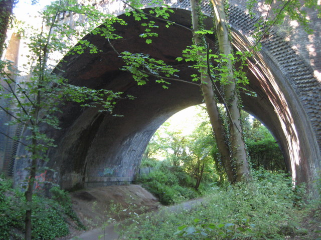
Image: © Nigel Cox Taken: 29 May 2009
The sheer size of this massive single arch bridge has to be seen to be appreciated. It was built by the Midland Railway around 1868 to take their main line to London over the already existing Hatfield & St Albans Railway which had been completed and opened three years earlier. In 1883 the Hatfield & St Albans Railway was taken over by the Great Northern Railway, but it was a very early casualty of British Railways' days being closed to passenger traffic in 1951. Freight services lingered on until 1964. The trackbed itself is now a public path known as the Alban Way and it also forms a section of National Cycle Network Route 61. For a more distant view of the bridge please see Image
Images are licensed for reuse under creativecommons.org/licenses/by-sa/2.0
Image Location
Latitude
51.745638
Longitude
-0.326543