St Albans Abbey railway station
Introduction
The photograph on this page of St Albans Abbey railway station by Nigel Cox as part of the Geograph project.
The Geograph project started in 2005 with the aim of publishing, organising and preserving representative images for every square kilometre of Great Britain, Ireland and the Isle of Man.

There are currently over 7.5m images from over 14,400 individuals and you can help contribute to the project by visiting https://www.geograph.org.uk
St Albans Abbey railway station
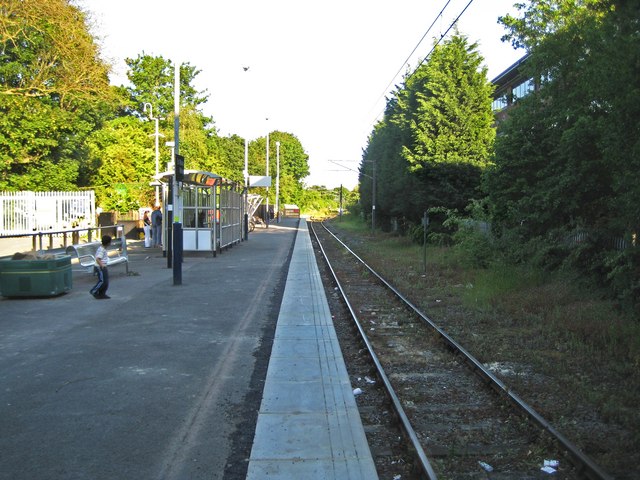
Image: © Nigel Cox Taken: 29 May 2009
There was a discussion on Radio 4's Today programme that touched on the subject of the drabness and unappealing look of some of the country's railway stations that serve tourist attractions. The tourist attraction here is obviously the Abbey and this is the eponymous station that serves it, at the end of the Abbey Flyer branch line from Watford Junction. Network Rail would argue that the minimalist facilities are essential in maintaining the economies necessary to keep the line open. Whatever, the station was the first in St Albans, being opened in 1858 by the London & North Western Railway some ten years before the Midland Railway built their separate main line to London through what is now St Albans City station. The railway line to Hatfield, which was completed in 1865, peeled off to the left about 400 metres away in the distance. Ordnance Survey maps of the second half of the 19th century and the first half of the 20th century show a large terminus station with a goods yard and sidings, including one to the nearby gasworks. Under the current timetable arrangements there is a train every 45 minutes or so to Watford Junction with a scheduled journey time of 16 minutes.
Images are licensed for reuse under creativecommons.org/licenses/by-sa/2.0
Image Location
Latitude
51.744338
Longitude
-0.34267