The Link Stone
Introduction
The photograph on this page of The Link Stone by Bob Embleton as part of the Geograph project.
The Geograph project started in 2005 with the aim of publishing, organising and preserving representative images for every square kilometre of Great Britain, Ireland and the Isle of Man.

There are currently over 7.5m images from over 14,400 individuals and you can help contribute to the project by visiting https://www.geograph.org.uk
The Link Stone
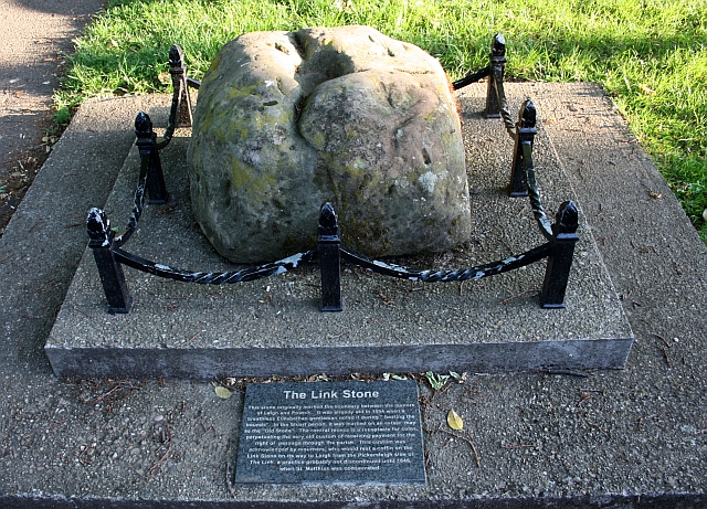
Image: © Bob Embleton Taken: 30 May 2009
Or Whore Stone on some old maps. Now in the churchyard of St. Matthias, Malvern Link, but would have been one of several markers delineating the parish bounds. Image Image
Images are licensed for reuse under creativecommons.org/licenses/by-sa/2.0
Image Location
Latitude
52.128168
Longitude
-2.317822