St Albans: Camp Road Bridge
Introduction
The photograph on this page of St Albans: Camp Road Bridge by Nigel Cox as part of the Geograph project.
The Geograph project started in 2005 with the aim of publishing, organising and preserving representative images for every square kilometre of Great Britain, Ireland and the Isle of Man.

There are currently over 7.5m images from over 14,400 individuals and you can help contribute to the project by visiting https://www.geograph.org.uk
St Albans: Camp Road Bridge
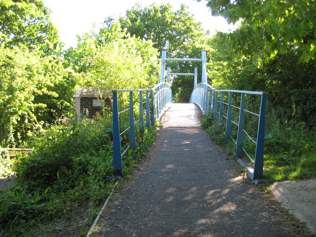
Image: © Nigel Cox Taken: 29 May 2009
The blue bridge was opened in 2003 and reinstated the former Hatfield and St Albans Railway bridge crossing over Camp Road at this location. The railway was completed in 1865 and was taken over by the Great Northern Railway in 1883. It was a very early casualty of British Railways' days being closed to passenger traffic in 1951. Freight services lingered on until 1964. The trackbed itself is now a public path known as the Alban Way and it also forms a section of National Cycle Network Route 61. See Barry's Image for a view from the other side in January 2006.
Images are licensed for reuse under creativecommons.org/licenses/by-sa/2.0
Image Location
Latitude
51.749135
Longitude
-0.319605