Watford: Occupation Road and Watford FC ground
Introduction
The photograph on this page of Watford: Occupation Road and Watford FC ground by Nigel Cox as part of the Geograph project.
The Geograph project started in 2005 with the aim of publishing, organising and preserving representative images for every square kilometre of Great Britain, Ireland and the Isle of Man.

There are currently over 7.5m images from over 14,400 individuals and you can help contribute to the project by visiting https://www.geograph.org.uk
Watford: Occupation Road and Watford FC ground
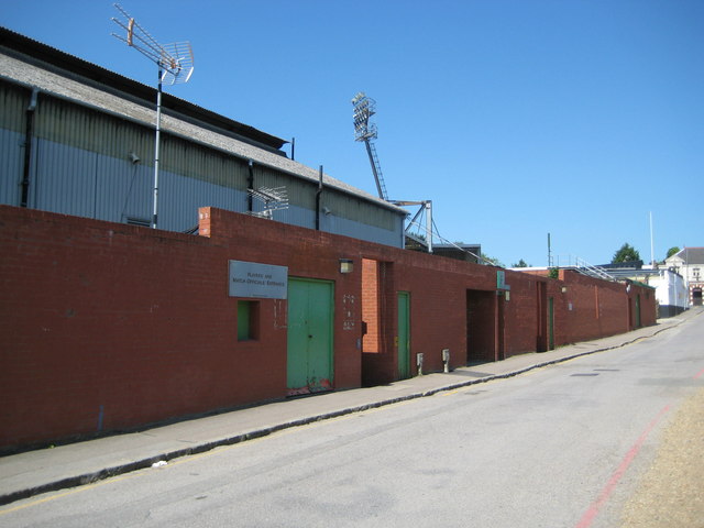
Image: © Nigel Cox Taken: 24 May 2009
Occupation Road runs down the east side of Watford FC's Vicarage Road ground and this is the rather unassuming "Players' and Match Officials' Entrance". The structure to the left is the east stand and this is the oldest at the ground, that the club have occupied since 1922. Up the hill are further turnstiles to the ground and just visible at the top of the hill is the doorway entrance to Image
Images are licensed for reuse under creativecommons.org/licenses/by-sa/2.0
Image Location
Latitude
51.650279
Longitude
-0.400887