Bishopston Fundamental Benchmark
Introduction
The photograph on this page of Bishopston Fundamental Benchmark by Hywel Williams as part of the Geograph project.
The Geograph project started in 2005 with the aim of publishing, organising and preserving representative images for every square kilometre of Great Britain, Ireland and the Isle of Man.

There are currently over 7.5m images from over 14,400 individuals and you can help contribute to the project by visiting https://www.geograph.org.uk
Bishopston Fundamental Benchmark
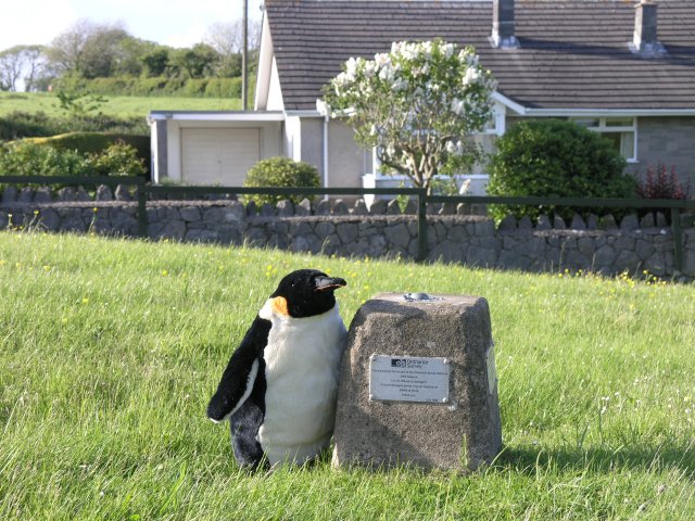
Image: © Hywel Williams Taken: 27 May 2009
Unlike the familiar triangulation points which have now largely been abandoned, the fundamental benchmarks are still in use by the Ordnance Survey as passive GPS stations (as mentioned by the modern plaques placed on these monuments by the OS). Indeed, a man from the O.S. was seen only a day or so previously with a GPSr on a tripod measuring this location.
Images are licensed for reuse under creativecommons.org/licenses/by-sa/2.0
Image Location


Leaflet Map data © OpenStreetMap
Latitude
51.585102
Longitude
-4.059072