Highbridge Clyce
Introduction
The photograph on this page of Highbridge Clyce by Kerryn as part of the Geograph project.
The Geograph project started in 2005 with the aim of publishing, organising and preserving representative images for every square kilometre of Great Britain, Ireland and the Isle of Man.

There are currently over 7.5m images from over 14,400 individuals and you can help contribute to the project by visiting https://www.geograph.org.uk
Highbridge Clyce
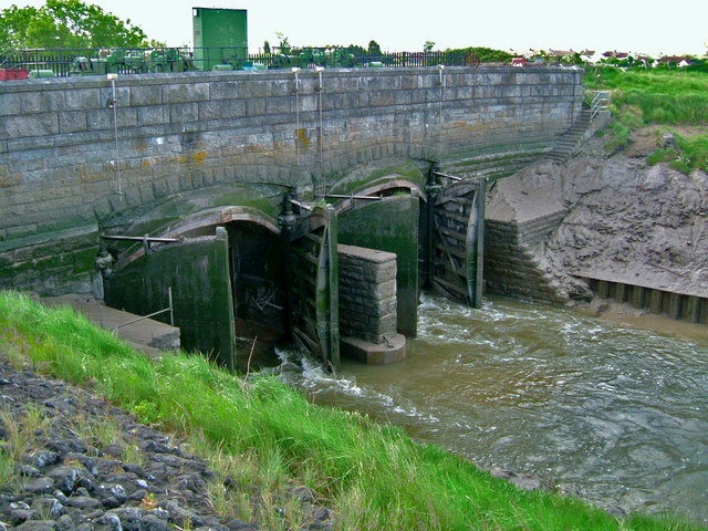
Image: © Kerryn Taken: 22 May 2009
From 1801 to 1809 French prisoners of war were used to help cut a new channel for the River Brue where it runs through Highbridge, ending at what is still called New Clyce Bridge. ‘Clyce’ is the Somerset word for a dam, lock or sluice. At low tide the river runs freely, but the incoming tide closes the gates, preventing salt water from flooding inland.
Images are licensed for reuse under creativecommons.org/licenses/by-sa/2.0
Image Location


Leaflet Map data © OpenStreetMap
Latitude
51.220211
Longitude
-2.984368