Sluice Gates, Town Mill, Buckingham
Introduction
The photograph on this page of Sluice Gates, Town Mill, Buckingham by Mark R Dornan as part of the Geograph project.
The Geograph project started in 2005 with the aim of publishing, organising and preserving representative images for every square kilometre of Great Britain, Ireland and the Isle of Man.

There are currently over 7.5m images from over 14,400 individuals and you can help contribute to the project by visiting https://www.geograph.org.uk
Sluice Gates, Town Mill, Buckingham
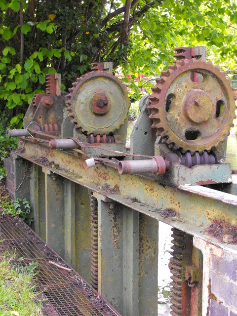
Image: © Mark R Dornan Taken: 23 May 2009
These racks are used to lift the sluice gates that control water levels in the mill race just upstream of the mill. Lifting the gates allows excess water in the race to be released back through the sluice into the River Ouse.
Images are licensed for reuse under creativecommons.org/licenses/by-sa/2.0
Image Location
Latitude
51.995884
Longitude
-0.990021