Clerkenwell: Exmouth Arms
Introduction
The photograph on this page of Clerkenwell: Exmouth Arms by Nigel Cox as part of the Geograph project.
The Geograph project started in 2005 with the aim of publishing, organising and preserving representative images for every square kilometre of Great Britain, Ireland and the Isle of Man.

There are currently over 7.5m images from over 14,400 individuals and you can help contribute to the project by visiting https://www.geograph.org.uk
Clerkenwell: Exmouth Arms
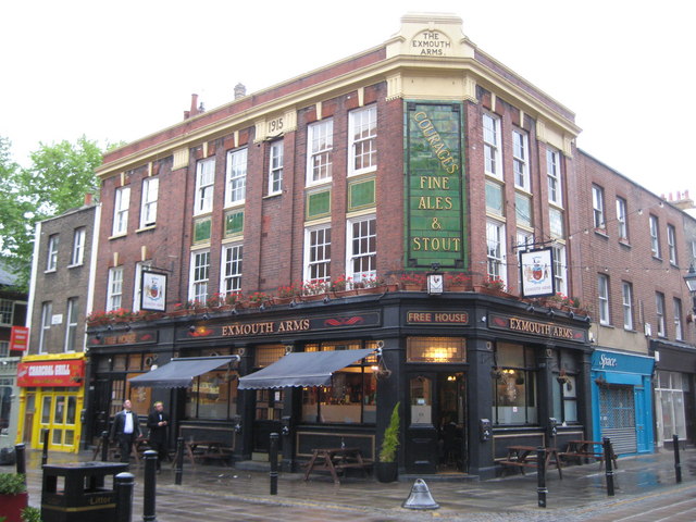
Image: © Nigel Cox Taken: 17 May 2009
"Courages Fine Ales & Stout" is picked out on the glazed tiles on this public house in Exmouth Market opposite Image There is a date of 1915 in a tablet high up on the left side. The pub has a currently somewhat minimalist website here http://exmoutharms.com/ Exmouth Market was formerly known as Exmouth Street, the change having taken place at some time between the publication of the 1920 and 1938 Editions of the Ordnance Survey 6" to the mile mapping.
Images are licensed for reuse under creativecommons.org/licenses/by-sa/2.0
Image Location
Latitude
51.525724
Longitude
-0.109731