Gap, Banbridge bypass (1)
Introduction
The photograph on this page of Gap, Banbridge bypass (1) by Albert Bridge as part of the Geograph project.
The Geograph project started in 2005 with the aim of publishing, organising and preserving representative images for every square kilometre of Great Britain, Ireland and the Isle of Man.

There are currently over 7.5m images from over 14,400 individuals and you can help contribute to the project by visiting https://www.geograph.org.uk
Gap, Banbridge bypass (1)
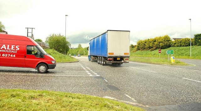
Image: © Albert Bridge Taken: 19 May 2009
The Banbridge bypass (in common with most of the road) was built as an all-purpose dual carriageway allowing right and “U” turns. The high number of minor side roads in Co Down means that there are frequent gaps in the central reservation. The road has been improved with two flyovers Image and Image but two gaps remain. One is a minor (and little-used road) while this one (the Old Manse Road Image) leads to an “A” road to Banbridge and Castlewellan Image and is quite busy. See also Image The driver of this van was waiting patiently for a gap in the traffic before turning right, across the dual carriageway, towards Belfast. To the best of my knowledge there are no plans to close the gap or replace it with a grade-separated junction.
Images are licensed for reuse under creativecommons.org/licenses/by-sa/2.0
Image Location
Latitude
54.345927
Longitude
-6.248477