Cottages, Broadclyst
Introduction
The photograph on this page of Cottages, Broadclyst by Derek Harper as part of the Geograph project.
The Geograph project started in 2005 with the aim of publishing, organising and preserving representative images for every square kilometre of Great Britain, Ireland and the Isle of Man.

There are currently over 7.5m images from over 14,400 individuals and you can help contribute to the project by visiting https://www.geograph.org.uk
Cottages, Broadclyst
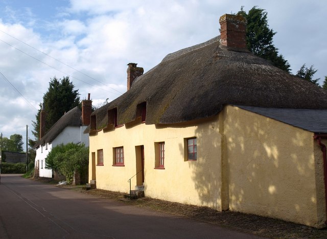
Image: © Derek Harper Taken: 15 May 2009
These thatched cottages also appear in Image and Image On the right is Marker's Cottage, owned by the National Trust, dating back to the C15. A detailed account of the history and architecture is at http://www.imagesofengland.org.uk/details/default.aspx?id=88443 . Beyond is Symes Cottage, C17 and later - see http://www.imagesofengland.org.uk/Details/Default.aspx?id=88442&mode=adv .
Images are licensed for reuse under creativecommons.org/licenses/by-sa/2.0
Image Location
Latitude
50.765756
Longitude
-3.440189