15 - 21 Bell Street
Introduction
The photograph on this page of 15 - 21 Bell Street by Ian Capper as part of the Geograph project.
The Geograph project started in 2005 with the aim of publishing, organising and preserving representative images for every square kilometre of Great Britain, Ireland and the Isle of Man.

There are currently over 7.5m images from over 14,400 individuals and you can help contribute to the project by visiting https://www.geograph.org.uk
15 - 21 Bell Street
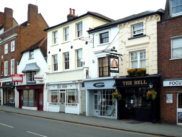
Image: © Ian Capper Taken: 3 May 2009
All these group of buildings are listed. 15/15a, the low building on the left, is said to include the remains of the 14th century St Lawrence's Chapel. It is grade II* listed - see www.historicengland.org.uk/listing/the-list/list-entry/1029128. 17, in the middle, is from the 19th century and is grade II listed - see www.historicengland.org.uk/listing/the-list/list-entry/1029129. 19/21, on the right, the right hand section of which forms the Bell pub, after which Bell Street is named, are also from the 19th century and grade II listed - see www.historicengland.org.uk/listing/the-list/list-entry/1029130.
Images are licensed for reuse under creativecommons.org/licenses/by-sa/2.0
Image Location
Latitude
51.237251
Longitude
-0.205398