Grainhill
Introduction
The photograph on this page of Grainhill by Anne Burgess as part of the Geograph project.
The Geograph project started in 2005 with the aim of publishing, organising and preserving representative images for every square kilometre of Great Britain, Ireland and the Isle of Man.

There are currently over 7.5m images from over 14,400 individuals and you can help contribute to the project by visiting https://www.geograph.org.uk
Grainhill
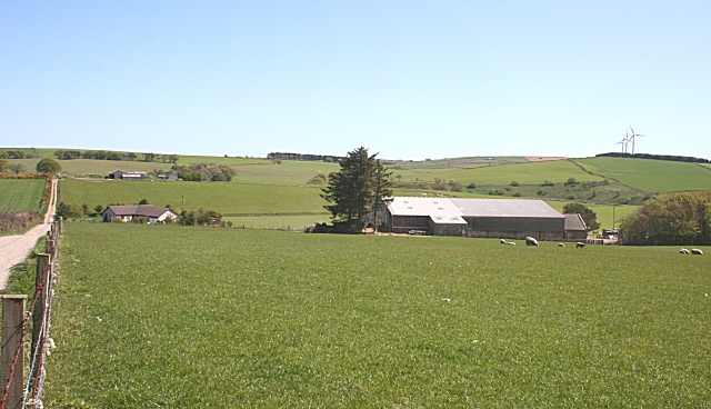
Image: © Anne Burgess Taken: 14 May 2009
The nearest barn is at West Grainhill, and the most distant buildings are at East Grainhill. In between is a new bungalow called Grainhill House. The 1:25,000 maps suggests that the road goes through to Newmill on the other side of the glen, but the 1:50,000 map shows only a path beyond East Grainhill. I speculate that the name has nothing to do with grain crops, but may be from Gaelic 'grian', meaning 'sun'.
Images are licensed for reuse under creativecommons.org/licenses/by-sa/2.0
Image Location
Latitude
57.482193
Longitude
-2.261152