St Albans: New Barnes Mill
Introduction
The photograph on this page of St Albans: New Barnes Mill by Nigel Cox as part of the Geograph project.
The Geograph project started in 2005 with the aim of publishing, organising and preserving representative images for every square kilometre of Great Britain, Ireland and the Isle of Man.

There are currently over 7.5m images from over 14,400 individuals and you can help contribute to the project by visiting https://www.geograph.org.uk
St Albans: New Barnes Mill
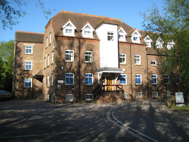
Image: © Nigel Cox Taken: 11 May 2009
New Barnes Mill is a former corn mill, now converted to offices, on the River Ver where Cottonmill Lane crosses the river. Although the building is often referred to as Sopwell Mill, New Barnes Mill is its proper name. In fact the 1883 Ordnance Survey 6" to the mile map not only calls it Newbarns Mill, but the whole cluster of buildings around is described as New Barns with no mention of Sopwell at all. However, by the time that the 1899 Edition was published, the name Sopwell had materialized but the mill was by then called Newbarnes Mill. Cottonmill Lane, seen on the right, may have been adequate for 19th century mill carts, but its narrow double right-angled bend around the mill presents a challenge to 21st century motorists.
Images are licensed for reuse under creativecommons.org/licenses/by-sa/2.0
Image Location
Latitude
51.735946
Longitude
-0.327915