Boscombe, sand grading
Introduction
The photograph on this page of Boscombe, sand grading by Mike Faherty as part of the Geograph project.
The Geograph project started in 2005 with the aim of publishing, organising and preserving representative images for every square kilometre of Great Britain, Ireland and the Isle of Man.

There are currently over 7.5m images from over 14,400 individuals and you can help contribute to the project by visiting https://www.geograph.org.uk
Boscombe, sand grading
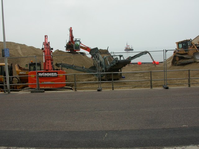
Image: © Mike Faherty Taken: 14 May 2009
Detail of work at Image Sand comes from the heap to the left, via an excavator; gravel is removed on the grader, into a lorry at front left, to be taken away; sand goes to the right, eventually to be pumped out via pipeline to the barge in the background, where it will be filled into large bags and lowered onto the first layer of bags, already in place. http://www.maritimejournal.com/archive101/2008/december/port_harbour__and__marine_construction/surfs_up_at_boscombes_artificial_reef
Images are licensed for reuse under creativecommons.org/licenses/by-sa/2.0
Image Location
Latitude
50.720225
Longitude
-1.839308