Rothes Burgh Chambers
Introduction
The photograph on this page of Rothes Burgh Chambers by Anne Burgess as part of the Geograph project.
The Geograph project started in 2005 with the aim of publishing, organising and preserving representative images for every square kilometre of Great Britain, Ireland and the Isle of Man.

There are currently over 7.5m images from over 14,400 individuals and you can help contribute to the project by visiting https://www.geograph.org.uk
Rothes Burgh Chambers
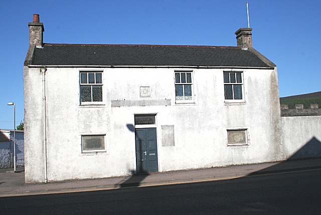
Image: © Anne Burgess Taken: 12 May 2009
It was recently reported in the local press that the Burgh Chambers are to be demolished as part of the Rothes flood alleviation works. Built in 1926, this was the seat of the burgh council until the council ceased to exist in the reorganisation of local government in the 1970s.
Images are licensed for reuse under creativecommons.org/licenses/by-sa/2.0
Image Location
Latitude
57.527344
Longitude
-3.207948