Trent and Mersey Canal, South Middlewich.
Introduction
The photograph on this page of Trent and Mersey Canal, South Middlewich. by Colin Smith as part of the Geograph project.
The Geograph project started in 2005 with the aim of publishing, organising and preserving representative images for every square kilometre of Great Britain, Ireland and the Isle of Man.

There are currently over 7.5m images from over 14,400 individuals and you can help contribute to the project by visiting https://www.geograph.org.uk
Trent and Mersey Canal, South Middlewich.
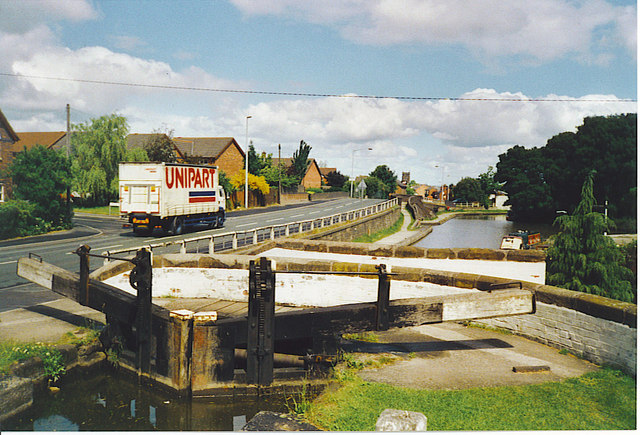
Image: © Colin Smith Taken: Unknown
The main road into Middlewich from the south parallels the canal. The arched bridge at the canal junction is just visible in the left distance. The bridge in foreground, behind the lock gate, leads to the Kings Lock Inn, a canalside pub. The area was worked for salt and is still industrial, with chemicals produced.
Images are licensed for reuse under creativecommons.org/licenses/by-sa/2.0
Image Location


Leaflet Map data © OpenStreetMap
Latitude
53.187578
Longitude
-2.439942