A414 North Orbital Road near St Albans
Introduction
The photograph on this page of A414 North Orbital Road near St Albans by Nigel Cox as part of the Geograph project.
The Geograph project started in 2005 with the aim of publishing, organising and preserving representative images for every square kilometre of Great Britain, Ireland and the Isle of Man.

There are currently over 7.5m images from over 14,400 individuals and you can help contribute to the project by visiting https://www.geograph.org.uk
A414 North Orbital Road near St Albans
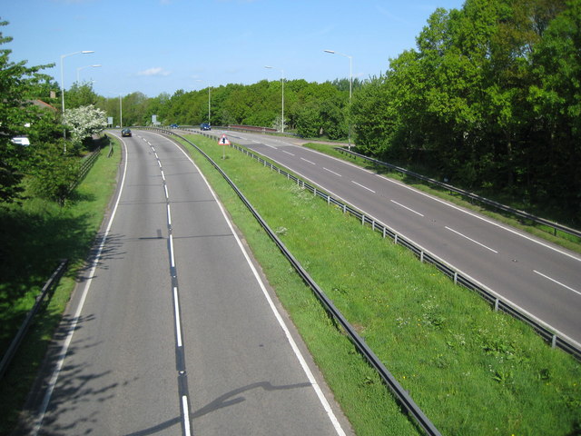
Image: © Nigel Cox Taken: 10 May 2009
The North Orbital Road was an early precursor to the M25 Motorway and was planned in the 1920s as a road circulating around the north side of London at about a 20 mile radius of Charing Cross. It was planned to start at Colnbrook on the A4 and, skirting past Rickmansworth, St Albans, Hatfield, Hoddesdon, and Brentwood, to terminate at Tilbury, a distance of about 75 miles. In the event only sections of it got built before the Second World War intervened. Some sections of it were then planned to be incorporated into Ringway 4, the outermost of the four London ringways that were designed, but never built, in the 1970s. This is one of the original sections of the road to the south of St Albans, viewed from the Napsbury Lane bridge. The Ordnance Survey 6" to 1 mile map of 1925 does not show it, but the 1938 Edition does, which gives a clue at to when it was built.
Images are licensed for reuse under creativecommons.org/licenses/by-sa/2.0
Image Location
Latitude
51.731144
Longitude
-0.319114