Sheffield: Furnival and Victoria Station Roads
Introduction
The photograph on this page of Sheffield: Furnival and Victoria Station Roads by Chris Downer as part of the Geograph project.
The Geograph project started in 2005 with the aim of publishing, organising and preserving representative images for every square kilometre of Great Britain, Ireland and the Isle of Man.

There are currently over 7.5m images from over 14,400 individuals and you can help contribute to the project by visiting https://www.geograph.org.uk
Sheffield: Furnival and Victoria Station Roads
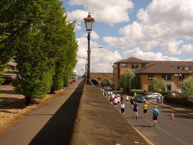
Image: © Chris Downer Taken: 26 Apr 2009
Looking along the balustrade which separates Image (at ground level) and Victoria Station Road (left). They run parallel from the horizontal point of view, but the latter goes uphill to what used to be Royal Victoria Station. The hotel alongside the former station is now a Holiday Inn. The Sheffield Half Marathon is currently taking place on Furnival Road. See also Image
Images are licensed for reuse under creativecommons.org/licenses/by-sa/2.0
Image Location
Latitude
53.385376
Longitude
-1.460668