Shoddy new housing at Leadgate
Introduction
The photograph on this page of Shoddy new housing at Leadgate by Oliver Dixon as part of the Geograph project.
The Geograph project started in 2005 with the aim of publishing, organising and preserving representative images for every square kilometre of Great Britain, Ireland and the Isle of Man.

There are currently over 7.5m images from over 14,400 individuals and you can help contribute to the project by visiting https://www.geograph.org.uk
Shoddy new housing at Leadgate
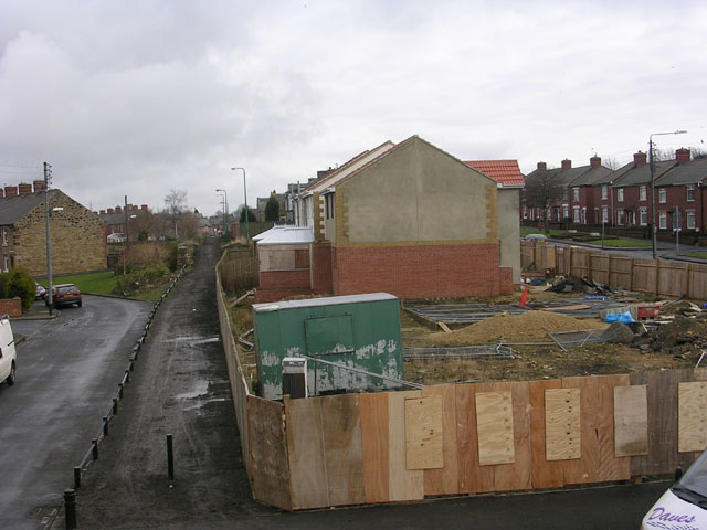
Image: © Oliver Dixon Taken: 18 Feb 2005
The builder went bankrupt and the houses were uninhabitable. The path on the left running into the distance is the Consett and Sunderland Railway path, part of the C2C cycle route
Images are licensed for reuse under creativecommons.org/licenses/by-sa/2.0
Image Location
Latitude
54.859043
Longitude
-1.811479