Rothienorman Parish Kirk
Introduction
The photograph on this page of Rothienorman Parish Kirk by Anne Burgess as part of the Geograph project.
The Geograph project started in 2005 with the aim of publishing, organising and preserving representative images for every square kilometre of Great Britain, Ireland and the Isle of Man.

There are currently over 7.5m images from over 14,400 individuals and you can help contribute to the project by visiting https://www.geograph.org.uk
Rothienorman Parish Kirk
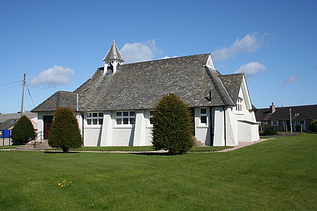
Image: © Anne Burgess Taken: 7 May 2009
This is a most unusual, definitely not traditional, style of kirk. It was designed by George Bennett Mitchell and Son and built in 1935/6.
Images are licensed for reuse under creativecommons.org/licenses/by-sa/2.0
Image Location
Latitude
57.410201
Longitude
-2.462872