Knocknalling House, near to St. John's Town of Dalry
Introduction
The photograph on this page of Knocknalling House, near to St. John's Town of Dalry by J Taylor as part of the Geograph project.
The Geograph project started in 2005 with the aim of publishing, organising and preserving representative images for every square kilometre of Great Britain, Ireland and the Isle of Man.

There are currently over 7.5m images from over 14,400 individuals and you can help contribute to the project by visiting https://www.geograph.org.uk
Knocknalling House, near to St. John's Town of Dalry
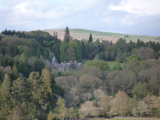
Image: © J Taylor Taken: 3 May 2009
Knocknalling:(c.1840): Gabled country house in mild Tudor style. Baronial stable block with clock tower (c.1880). Fine C19 barn. Windy Standard wind farm can be seen on the horizon.
Images are licensed for reuse under creativecommons.org/licenses/by-sa/2.0
Image Location
Latitude
55.137523
Longitude
-4.203089