Dudley Road, Wolverhampton
Introduction
The photograph on this page of Dudley Road, Wolverhampton by Roger D Kidd as part of the Geograph project.
The Geograph project started in 2005 with the aim of publishing, organising and preserving representative images for every square kilometre of Great Britain, Ireland and the Isle of Man.

There are currently over 7.5m images from over 14,400 individuals and you can help contribute to the project by visiting https://www.geograph.org.uk
Dudley Road, Wolverhampton
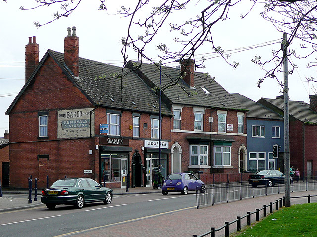
Image: © Roger D Kidd Taken: 11 Apr 2009
This is at the junction with Byrne Road and shows old wall advertising and wide pavements which have recently been provided as part of the Blakenhall "regeneration". Formerly the road was quite wide but now it has been narrowed to provide useful parking spaces (at the cost of traffic standstill every time a bus stops!) The area is generally "ethnic" and there are many shops, small/medium sized supermarkets, pubs and places of worship catering for those communities. (Dudley Road is a very good place to come for all your spicy cooking ingredients!)
Images are licensed for reuse under creativecommons.org/licenses/by-sa/2.0
Image Location
Latitude
52.571656
Longitude
-2.12493