Tracks across the road
Introduction
The photograph on this page of Tracks across the road by Mick Lobb as part of the Geograph project.
The Geograph project started in 2005 with the aim of publishing, organising and preserving representative images for every square kilometre of Great Britain, Ireland and the Isle of Man.

There are currently over 7.5m images from over 14,400 individuals and you can help contribute to the project by visiting https://www.geograph.org.uk
Tracks across the road
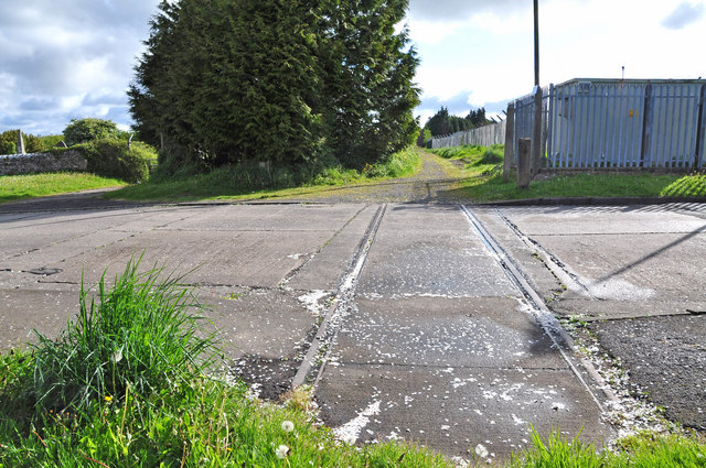
Image: © Mick Lobb Taken: 3 May 2009
These tracks cross the road at the old North Gate approach to what was RAF St Athan. The track beyond to a derelict two storey red brick building. I have no knowledge of the purpose of either of the tracks. Was this once a rail track of some description and the building a terminus of some sort?
Images are licensed for reuse under creativecommons.org/licenses/by-sa/2.0
Image Location
Latitude
51.411393
Longitude
-3.450611