Stoneacre, Otham, Kent
Introduction
The photograph on this page of Stoneacre, Otham, Kent by Oast House Archive as part of the Geograph project.
The Geograph project started in 2005 with the aim of publishing, organising and preserving representative images for every square kilometre of Great Britain, Ireland and the Isle of Man.

There are currently over 7.5m images from over 14,400 individuals and you can help contribute to the project by visiting https://www.geograph.org.uk
Stoneacre, Otham, Kent
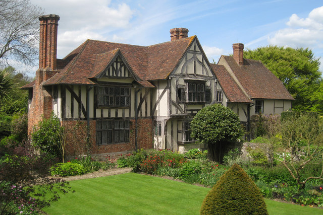
Image: © Oast House Archive Taken: 2 May 2009
15th century Yeoman's hall house. The house was restored in the 1920's, and the left wing and rear section were added. Donated to the National Trust in 1928. Grade II* listed.
Images are licensed for reuse under creativecommons.org/licenses/by-sa/2.0
Image Location
Latitude
51.252083
Longitude
0.577657