
Listed Wall & Railings, Tow Law, Co. Durham
Introduction
The photograph on this page of Listed Wall & Railings, Tow Law, Co. Durham by Ian Porter as part of the Geograph project.
The Geograph project started in 2005 with the aim of publishing, organising and preserving representative images for every square kilometre of Great Britain, Ireland and the Isle of Man.

There are currently over 7.5m images from over 14,400 individuals and you can help contribute to the project by visiting https://www.geograph.org.uk
Listed Wall & Railings, Tow Law, Co. Durham
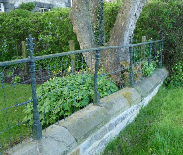
Image: © Ian Porter Taken: 1 May 2009
This is a part of a wall and railings which are listed in their own right. The houses they stand in front of are also listed and are known as Attwood Place. English Heritages full description is as follows: "23/314 Walls and railings in front of Nos. 1-5 Attwood Place GV II Walls and railings. Mid C19. Coursed squared sandstone walls with chamfered ashlar coping; cast iron posts in acanthus-bud pattern have leafy finials: interlaced twisted wire fence visible in places, partly removed and partly hidden by plants." I am slightly puzzled that the posts have a distinct green hue but there is no mention of copper? Keys to the past: http://www.keystothepast.info/article/10339/Site-Details?PRN=D37695 The name "Attwood" associated with the buildings is intrinsically linked with the growth of Tow Law from a lone farmhouse to a thriving town with a population of 5000 in just 40 years. The history of the town and Charles Attwood are linked with The Knights of Brittany (1351), The Bessemer Process, The Crimean War, Barings Bank and more. There is much information on the history at http://towlawhistory.webs.com/charles-attwood and http://towlawhistory.webs.com/history
Images are licensed for reuse under creativecommons.org/licenses/by-sa/2.0
Image Location

Latitude
54.745128
Longitude
-1.821282