West Street
Introduction
The photograph on this page of West Street by Ian Capper as part of the Geograph project.
The Geograph project started in 2005 with the aim of publishing, organising and preserving representative images for every square kilometre of Great Britain, Ireland and the Isle of Man.

There are currently over 7.5m images from over 14,400 individuals and you can help contribute to the project by visiting https://www.geograph.org.uk
West Street
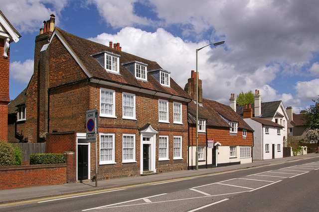
Image: © Ian Capper Taken: 25 Apr 2009
The three houses are (from left to right): Old West Street House, a grade II listed late 17th century house, originally timber framed (as can be seen on the end gable) but refronted in the 18th century. It was once a school. For listing particulars see www.historicengland.org.uk/listing/the-list/list-entry/1189126. The Old Forge, also grade II listed, dating from around 1600. Note the central chimney. For listing particulars see www.historicengland.org.uk/listing/the-list/list-entry/1377964. The Cottage, locally listed.
Images are licensed for reuse under creativecommons.org/licenses/by-sa/2.0
Image Location
Latitude
51.239372
Longitude
-0.214155