Apethorn Farm
Introduction
The photograph on this page of Apethorn Farm by Gerald England as part of the Geograph project.
The Geograph project started in 2005 with the aim of publishing, organising and preserving representative images for every square kilometre of Great Britain, Ireland and the Isle of Man.

There are currently over 7.5m images from over 14,400 individuals and you can help contribute to the project by visiting https://www.geograph.org.uk
Apethorn Farm
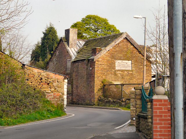
Image: © Gerald England Taken: 20 Apr 2009
A grade II* listed building. Originally a cruck-framed longhouse from the 15th century, it was encased in rubble in the 17th century and later with brick. The scene of a murder in 1831, it was divided into cottages in 1928 but in 1993 a fire reduced to it to just the original cruck frame. More information: http://oldhyde.blogspot.com/2007/08/apethorne-farmhouse.html
Images are licensed for reuse under creativecommons.org/licenses/by-sa/2.0
Image Location
Latitude
53.437528
Longitude
-2.083656