Ayr's Malt Cross - Where Witches Were Burned
Introduction
The photograph on this page of Ayr's Malt Cross - Where Witches Were Burned by Mary and Angus Hogg as part of the Geograph project.
The Geograph project started in 2005 with the aim of publishing, organising and preserving representative images for every square kilometre of Great Britain, Ireland and the Isle of Man.

There are currently over 7.5m images from over 14,400 individuals and you can help contribute to the project by visiting https://www.geograph.org.uk
Ayr's Malt Cross - Where Witches Were Burned
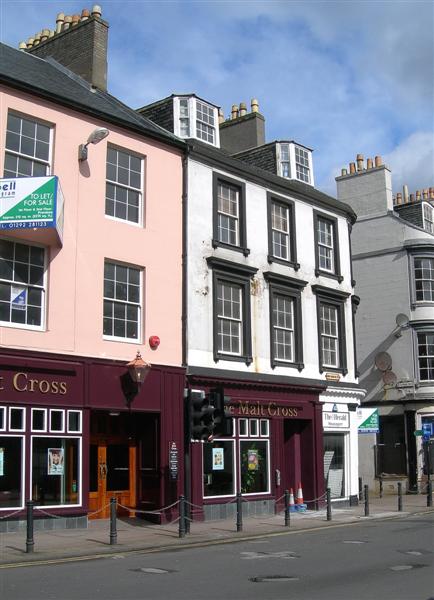
Image: © Mary and Angus Hogg Taken: 28 Apr 2009
The pub in this photo takes its name from the old Malt Cross of Ayr which formerly stood at the junction of High Street and the Sandgate. The exact location is marked by cobbled stones in the tarmac in the foreground of this photo. This was the place where the witch, Maggie Osborne, was burnt to death in 1629 - see Image The Malt Cross was removed in 1778 as it was obstructing the flow of traffic. (Source: “Ayrshire: Discovering A County”, by Dane Love.) An incident involving William Wallace is noted in Image
Images are licensed for reuse under creativecommons.org/licenses/by-sa/2.0
Image Location
Latitude
55.464696
Longitude
-4.634539