Duncanstone Chapel
Introduction
The photograph on this page of Duncanstone Chapel by Anne Burgess as part of the Geograph project.
The Geograph project started in 2005 with the aim of publishing, organising and preserving representative images for every square kilometre of Great Britain, Ireland and the Isle of Man.

There are currently over 7.5m images from over 14,400 individuals and you can help contribute to the project by visiting https://www.geograph.org.uk
Duncanstone Chapel
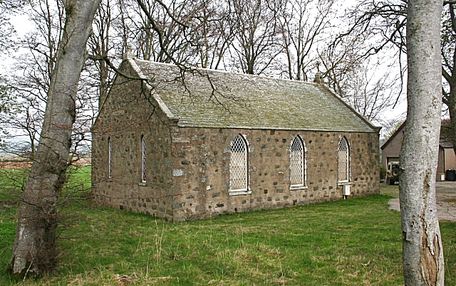
Image: © Anne Burgess Taken: 25 Apr 2009
I surmise that this is the former Congregational Church. A congregation was formed in the parish in 1808 and later built a chapel at Duncanstone, which was eventually closed in 1949. However I am happy to be corrected by anyone who knows better. It is evidently still cared for and has not been allowed to fall into ruin.
Images are licensed for reuse under creativecommons.org/licenses/by-sa/2.0
Image Location
Latitude
57.328428
Longitude
-2.702159