Airport Road West near Belfast
Introduction
The photograph on this page of Airport Road West near Belfast by Rossographer as part of the Geograph project.
The Geograph project started in 2005 with the aim of publishing, organising and preserving representative images for every square kilometre of Great Britain, Ireland and the Isle of Man.

There are currently over 7.5m images from over 14,400 individuals and you can help contribute to the project by visiting https://www.geograph.org.uk
Airport Road West near Belfast
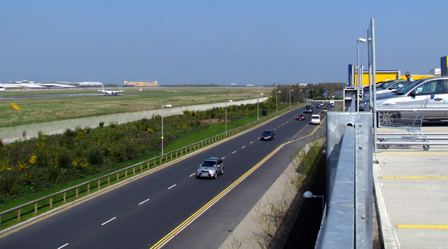
Image: © Rossographer Taken: 19 Apr 2009
Airport Road West runs through the eastern edge of the Belfast harbour estate and on to the Holywood Exchange retail park where it meets the A2 near Holywood. This section is approaching the end and is, in effect, a cul-de-sac built solely to serve the 'IKEA' store there. The picture is taken from the roof of the 'IKEA' car park and you can see part of the runway of George Best Belfast City Airport to the left, from where the road derives its name.
Images are licensed for reuse under creativecommons.org/licenses/by-sa/2.0
Image Location
Latitude
54.622041
Longitude
-5.863475