A New Kissing Gate near Nashes Farm, Sandridge
Introduction
The photograph on this page of A New Kissing Gate near Nashes Farm, Sandridge by Chris Reynolds as part of the Geograph project.
The Geograph project started in 2005 with the aim of publishing, organising and preserving representative images for every square kilometre of Great Britain, Ireland and the Isle of Man.

There are currently over 7.5m images from over 14,400 individuals and you can help contribute to the project by visiting https://www.geograph.org.uk
A New Kissing Gate near Nashes Farm, Sandridge
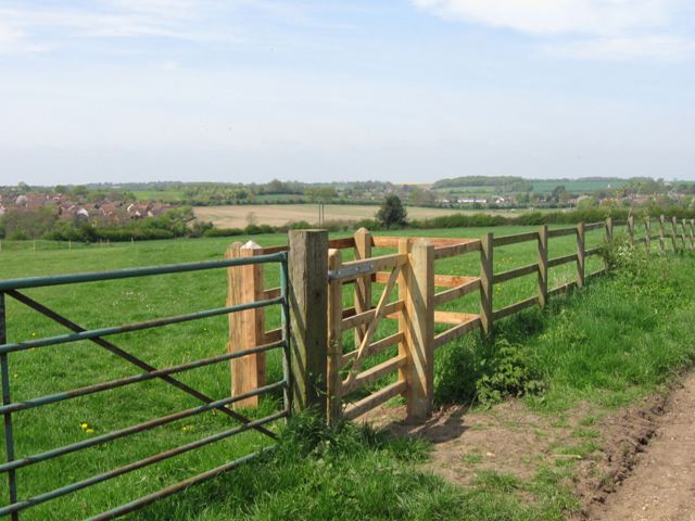
Image: © Chris Reynolds Taken: 23 Apr 2009
It is interesting to note that this is a wooden gate, while most new kissing gates in the area are metal and erected by the council. Perhaps this one was put in by the farmer. The housing estate on the left is the north end of Marshalswick (a 20th century extension of St Albans). The houses in the distance are part of the village of Sandridge.
Images are licensed for reuse under creativecommons.org/licenses/by-sa/2.0
Image Location
Latitude
51.773804
Longitude
-0.29057