Carreg Sampson from the southeast
Introduction
The photograph on this page of Carreg Sampson from the southeast by Natasha Ceridwen de Chroustchoff as part of the Geograph project.
The Geograph project started in 2005 with the aim of publishing, organising and preserving representative images for every square kilometre of Great Britain, Ireland and the Isle of Man.

There are currently over 7.5m images from over 14,400 individuals and you can help contribute to the project by visiting https://www.geograph.org.uk
Carreg Sampson from the southeast
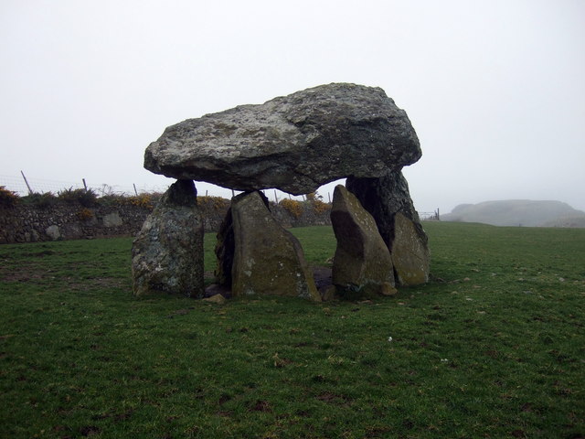
Image: © Natasha Ceridwen de Chroustchoff Taken: 11 Mar 2009
There are seven uprights of which four actually support the capstone. It was constructed over a pit and would once have been covered by a huge, rectangular, earth mound. The site was excavated in 1968 but all that was found was a few pieces of burnt bone and one neolithic pot.
Images are licensed for reuse under creativecommons.org/licenses/by-sa/2.0
Image Location
Latitude
51.957891
Longitude
-5.132743