Mutton Lane
Introduction
The photograph on this page of Mutton Lane by Martin Addison as part of the Geograph project.
The Geograph project started in 2005 with the aim of publishing, organising and preserving representative images for every square kilometre of Great Britain, Ireland and the Isle of Man.

There are currently over 7.5m images from over 14,400 individuals and you can help contribute to the project by visiting https://www.geograph.org.uk
Mutton Lane
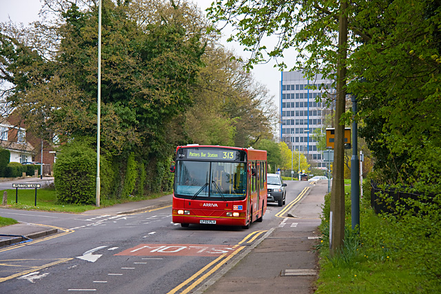
Image: © Martin Addison Taken: 14 Apr 2009
The houses on this stretch of the road are set back on service roads as evidenced by the road name on the left. The houses on the left are screened from the road by a hawthorn hedge. Tesco's car park is beyond, at the crest of the hill and the tall building behind is Maple House. A 313 drifts down the hill towards Potters Bar station. The vehicle is a DAF with Wright body.
Images are licensed for reuse under creativecommons.org/licenses/by-sa/2.0
Image Location
Latitude
51.692998
Longitude
-0.18481