Queen's Road, Croydon
Introduction
The photograph on this page of Queen's Road, Croydon by Peter Trimming as part of the Geograph project.
The Geograph project started in 2005 with the aim of publishing, organising and preserving representative images for every square kilometre of Great Britain, Ireland and the Isle of Man.

There are currently over 7.5m images from over 14,400 individuals and you can help contribute to the project by visiting https://www.geograph.org.uk
Queen's Road, Croydon
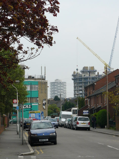
Image: © Peter Trimming Taken: 20 Apr 2009
The flats and houses on either side of the road were built c1976, replacing the Victorian terraced houses which lined both sides of the road. For a year I worked shifts. I remember walking along this road, one winter's night at about 11.30, on the way to start my nightshift. Damp air caused mist to form in the cemetery, which poured over the hedges and into the road. Then came the long terraces of boarded-up houses awaiting demolition. Not a soul was in sight ..... all very eerie. In the middle distance in this photograph is the residential block being built at Spurgeon's Bridge, and in the distance is the tower block beside East Croydon station.
Images are licensed for reuse under creativecommons.org/licenses/by-sa/2.0
Image Location
Latitude
51.385736
Longitude
-0.100271