Upper end of New Dam, near Netherthong
Introduction
The photograph on this page of Upper end of New Dam, near Netherthong by Humphrey Bolton as part of the Geograph project.
The Geograph project started in 2005 with the aim of publishing, organising and preserving representative images for every square kilometre of Great Britain, Ireland and the Isle of Man.

There are currently over 7.5m images from over 14,400 individuals and you can help contribute to the project by visiting https://www.geograph.org.uk
Upper end of New Dam, near Netherthong
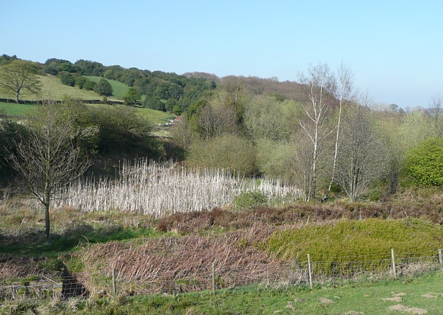
Image: © Humphrey Bolton Taken: 19 Apr 2009
New Dam is the name on a 1960s six-inch map, but it is named Holmroyd Reservoir on the 1850 map. I think that this reservoir stored water for Deanhouse Mills. It has been drained, but the bed is still wet judging by the stems of last year's bulrushes.
Images are licensed for reuse under creativecommons.org/licenses/by-sa/2.0
Image Location
Latitude
53.582834
Longitude
-1.806623