Approaching Treleddyd-fawr from the south
Introduction
The photograph on this page of Approaching Treleddyd-fawr from the south by Natasha Ceridwen de Chroustchoff as part of the Geograph project.
The Geograph project started in 2005 with the aim of publishing, organising and preserving representative images for every square kilometre of Great Britain, Ireland and the Isle of Man.

There are currently over 7.5m images from over 14,400 individuals and you can help contribute to the project by visiting https://www.geograph.org.uk
Approaching Treleddyd-fawr from the south
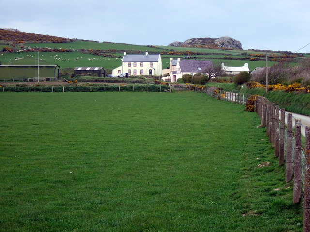
Image: © Natasha Ceridwen de Chroustchoff Taken: 16 Apr 2009
Treleddyd is one of a number of tiny hamlets scattered around the Dewisland peninsula. In the Middle Ages these hamlets had a semi-manorial relationship to the bishopric of St David's, which extracted tithes. Most of the land was held not by individual ownership, but by two persons and their co-owners, and cultivated in strips or blocks, additionally there were areas of common land, much of it rough moorland around the igneous outcrops such as the one seen above, Carn Trellwyd. The oldest building in this group, the cottage on the right, is at least two hundred years old; the large farmhouse on the left of more recent date. Many of these dwellings are now holiday lets.
Images are licensed for reuse under creativecommons.org/licenses/by-sa/2.0
Image Location
Latitude
51.903725
Longitude
-5.268993