Peace line, Belfast
Introduction
The photograph on this page of Peace line, Belfast by Rossographer as part of the Geograph project.
The Geograph project started in 2005 with the aim of publishing, organising and preserving representative images for every square kilometre of Great Britain, Ireland and the Isle of Man.

There are currently over 7.5m images from over 14,400 individuals and you can help contribute to the project by visiting https://www.geograph.org.uk
Peace line, Belfast
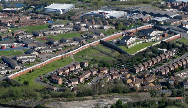
Image: © Rossographer Taken: 12 Apr 2009
A so-called 'Peace Line' http://en.wikipedia.org/wiki/Peace_line in west Belfast, separating a Protestant and Catholic neighbourhood from each other. The wall runs the length of the Springmartin Road and is about 18 feet high. The compound at the top of the wall is a police station.
Images are licensed for reuse under creativecommons.org/licenses/by-sa/2.0
Image Location
Latitude
54.59941
Longitude
-5.979179