St John's Priory
Introduction
The photograph on this page of St John's Priory by Simon Carey as part of the Geograph project.
The Geograph project started in 2005 with the aim of publishing, organising and preserving representative images for every square kilometre of Great Britain, Ireland and the Isle of Man.

There are currently over 7.5m images from over 14,400 individuals and you can help contribute to the project by visiting https://www.geograph.org.uk
St John's Priory
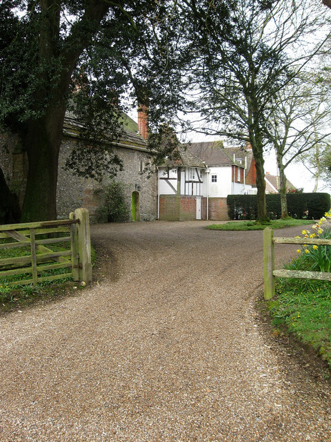
Image: © Simon Carey Taken: 13 Apr 2009
A preceptory built in around 1338 for the Knights Hospitallers and dissolved in 1541. A private residence for some time it has a number of extensions from different eras the last being added in the 1830s. Viewed from Poling Street.
Images are licensed for reuse under creativecommons.org/licenses/by-sa/2.0
Image Location
Latitude
50.841195
Longitude
-0.515202