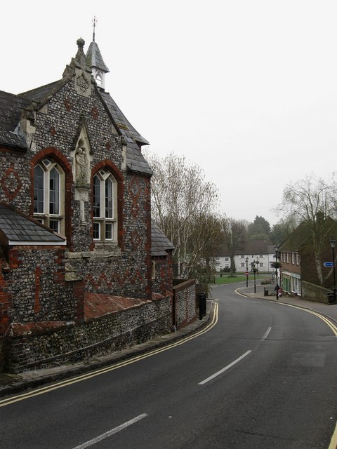
The Old School, Arundel Road
Introduction
The photograph on this page of The Old School, Arundel Road by Simon Carey as part of the Geograph project.
The Geograph project started in 2005 with the aim of publishing, organising and preserving representative images for every square kilometre of Great Britain, Ireland and the Isle of Man.
There are currently over 7.5m images from over 14,400 individuals and you can help contribute to the project by visiting https://www.geograph.org.uk

Image: © Simon Carey Taken: 13 Apr 2009
Looking down the hill to The Square in the distance. The first school on this site was built as far back as 1682 and was known as William Older's Charity School. That was demolished and rebuilt in 1853 and continued in operation until 1966 when two new schools were built to cope with the expansion of the village population. The building remained vacant until 1974 when it was purchased by the local council to prevent development and converted into the village's library which it remains today.

