Bredgar traffic calming
Introduction
The photograph on this page of Bredgar traffic calming by Penny Mayes as part of the Geograph project.
The Geograph project started in 2005 with the aim of publishing, organising and preserving representative images for every square kilometre of Great Britain, Ireland and the Isle of Man.

There are currently over 7.5m images from over 14,400 individuals and you can help contribute to the project by visiting https://www.geograph.org.uk
Bredgar traffic calming
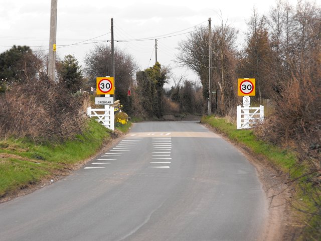
Image: © Penny Mayes Taken: 23 Mar 2009
This part of the traffic calming measures makes Bredgar look like a gated community. The moving of the 30 mile and hour limit a few metres south of its earlier position so that it now includes the frontage of Westfield Dairy (fence and flowers just visible on the left) seems a very sensible move. Not least because the new signs will not be obscured by the hedge as the old ones were. Traffic really does need to slow down here as the next part of the lane is very narrow, windy and lined with vertical paving slabs which won't do your car much good if you hit them. I never did hear a sensible explanation of this particular bit of 'highway maintenance' but do recall plenty of objections when the slabs were put in some years ago.
Images are licensed for reuse under creativecommons.org/licenses/by-sa/2.0
Image Location
Latitude
51.307484
Longitude
0.693545