Buncefield: Emergency fire water pond (1)
Introduction
The photograph on this page of Buncefield: Emergency fire water pond (1) by Nigel Cox as part of the Geograph project.
The Geograph project started in 2005 with the aim of publishing, organising and preserving representative images for every square kilometre of Great Britain, Ireland and the Isle of Man.

There are currently over 7.5m images from over 14,400 individuals and you can help contribute to the project by visiting https://www.geograph.org.uk
Buncefield: Emergency fire water pond (1)
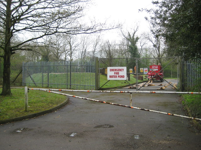
Image: © Nigel Cox Taken: 12 Apr 2009
Buncefield Oil Depot has several of these ponds scattered around the site. This one is on Buncefield Lane. Just how effective these ponds were in helping to deal with the disastrous explosion of 11 December 2005 is not known by an ordinary layman. Just over the boundary to the right is the site of the original Buncefield farm from which the oil depot got its name.
Images are licensed for reuse under creativecommons.org/licenses/by-sa/2.0
Image Location
Latitude
51.763873
Longitude
-0.429482