Buncefield: Three years and four months on (2)
Introduction
The photograph on this page of Buncefield: Three years and four months on (2) by Nigel Cox as part of the Geograph project.
The Geograph project started in 2005 with the aim of publishing, organising and preserving representative images for every square kilometre of Great Britain, Ireland and the Isle of Man.

There are currently over 7.5m images from over 14,400 individuals and you can help contribute to the project by visiting https://www.geograph.org.uk
Buncefield: Three years and four months on (2)
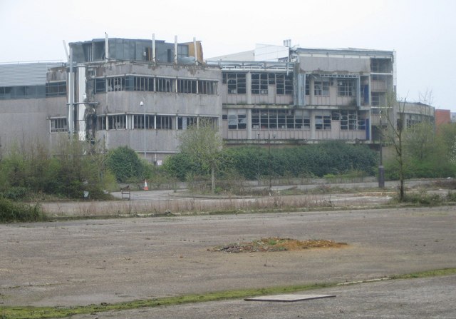
Image: © Nigel Cox Taken: 12 Apr 2009
Although most of the industrial buildings damaged during the explosion have been, or are, being repaired, and the most severely damaged ones have been demolished, some remain more or less as they were immediately after the explosion. This is the rear of one such building, viewed from Buncefield Lane, and the direction of the source of the explosion, across the car park of the now demolished Northgate Information Solutions building.
Images are licensed for reuse under creativecommons.org/licenses/by-sa/2.0
Image Location
Latitude
51.765162
Longitude
-0.431756