Moigns Down Barn
Introduction
The photograph on this page of Moigns Down Barn by Nigel Mykura as part of the Geograph project.
The Geograph project started in 2005 with the aim of publishing, organising and preserving representative images for every square kilometre of Great Britain, Ireland and the Isle of Man.

There are currently over 7.5m images from over 14,400 individuals and you can help contribute to the project by visiting https://www.geograph.org.uk
Moigns Down Barn
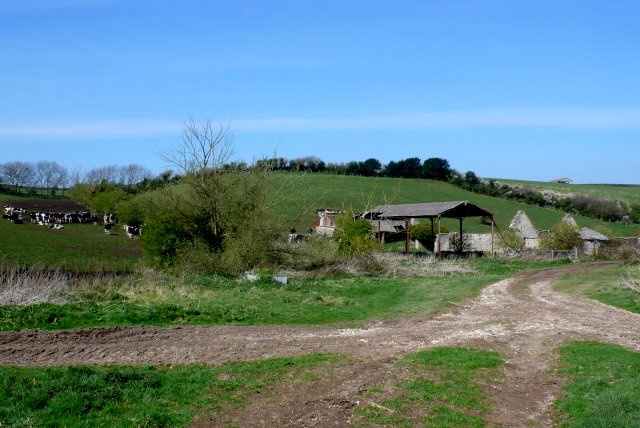
Image: © Nigel Mykura Taken: 12 Apr 2009
This is a large ruined stone barn with many associated farm buildings nestling in a sheltered combe on the north slopes of the down. All the buildings are extremely dilapidated and appear to be in state of imminent collapse.
Images are licensed for reuse under creativecommons.org/licenses/by-sa/2.0
Image Location


Leaflet Map data © OpenStreetMap
Latitude
50.654428
Longitude
-2.351475