St Mary's Tower
Introduction
The photograph on this page of St Mary's Tower by Malcolm Campbell as part of the Geograph project.
The Geograph project started in 2005 with the aim of publishing, organising and preserving representative images for every square kilometre of Great Britain, Ireland and the Isle of Man.

There are currently over 7.5m images from over 14,400 individuals and you can help contribute to the project by visiting https://www.geograph.org.uk
St Mary's Tower
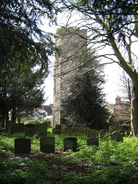
Image: © Malcolm Campbell Taken: 8 Apr 2009
Tower and graveyard of St Mary's Church - the tower was the only surviving building of the great fire which swept through the lower part of the town in 1742.
Images are licensed for reuse under creativecommons.org/licenses/by-sa/2.0
Image Location
Latitude
52.058665
Longitude
-0.855